10/23/07 - 2: 00 pm Updated
How to see almost real time map of fire on Google Earth.
- Download Google Earth here: http://earth.google.com/
- Then navigate to this link: http://activefiremaps.fs.fed.us/kml/conus.kmz
- And open the file using Google Earth.
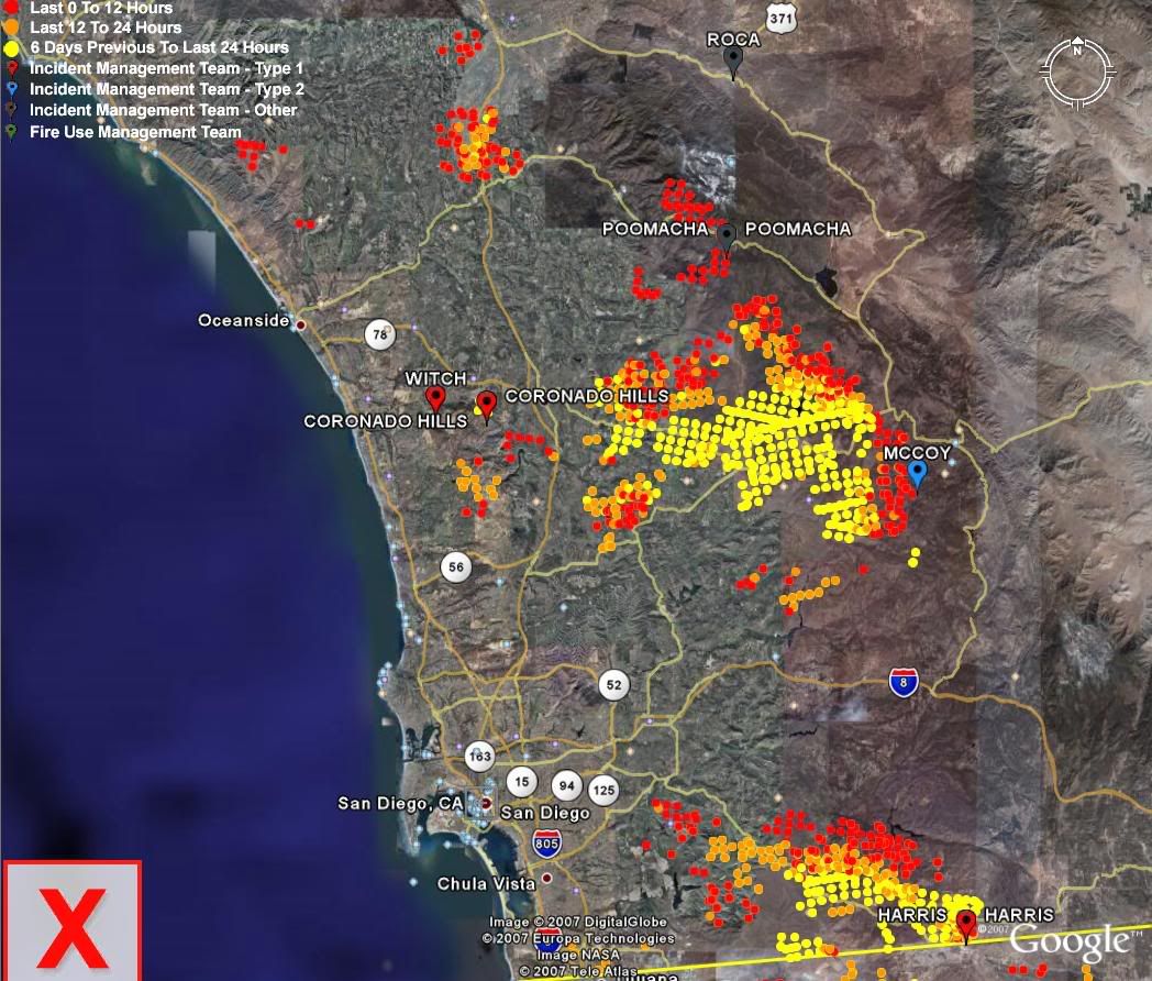
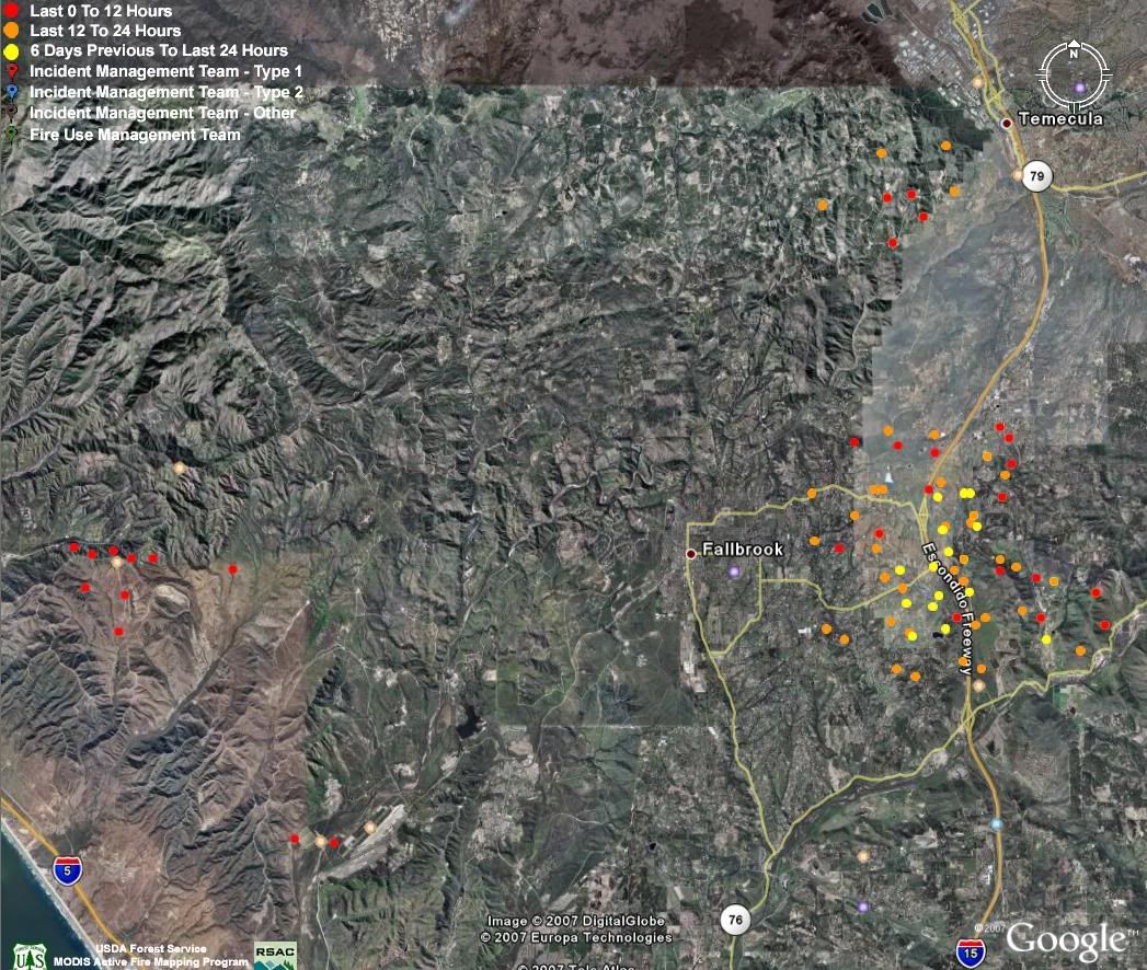
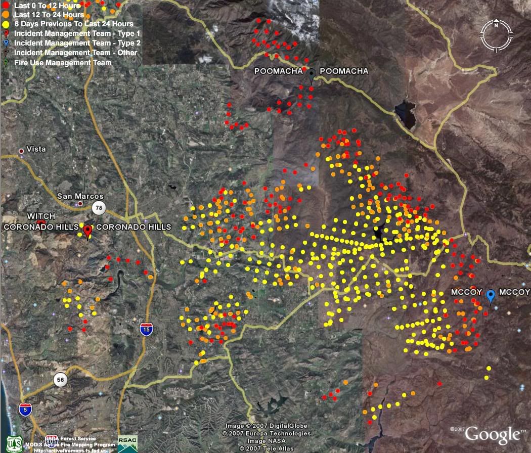
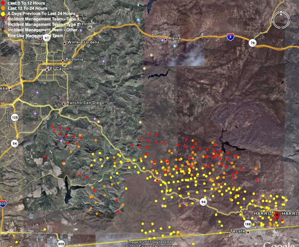
- It overlays the fire data fromthe USDA forest service with a satellite view of San Diego.
- You cantype in your home address in the top left bar to locate your home.
- Left clicking on the "CONUS MODIS Fire Detections and Current NIFCLarge Wildland Fire Incidents" indicates the time effective 12amtonight, but it seems pretty accurate.
San Diego News
Current radio broadcast (delayed by 5 minutes).
This site includes a list of homes supposedly destroyed by fire and freeway closure updates on the home page.
See Bruce Henderson’s site below for a map he made based on this information.
Site seems to be a bit behind on latest news most of the time.
Other Sites
Site by BRUCE HENDERSON: http://and-still-i-persist.com/?cat=50
VERY INFORMATIVE SITE with photos of the Escondido/Encinitas area that are not the same photos seen on the
news by former Marine, Bruce Henderson
ROAD Closures:
- http://www.caltrans8.info/
Suggest check this site and others before trying to drive somewhere. There are a few road closures due to winds. - Map seems older than other sites. California Fire News: http://calfire.blogspot.com/
- Discussion Forum & Map: http://www.topix.com/san-diego/2007/10/san-diego-harris-and-witch-fire-maps